North Las Vegas weatherWhat’s on in North Las Vegas →Events →
St. George

Get out of town

Day trips from North Las Vegas

11 nearby parks, towns and places to explore, ordered by straight-line distance.

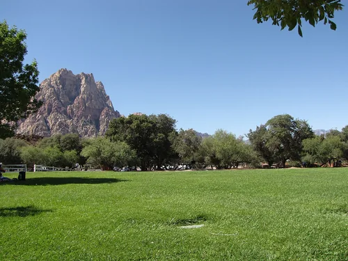
Spring Mountain Ranch State ParkState park

Spring Mountain Ranch State Park

21 miles southwest · straight-line distance

State park in Nevada, United States.

Confirm the visitor entrance, hours, reservations, access and seasonal conditions. Islands or water destinations may require different transport.
Boulder CityTown

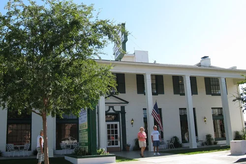
Boulder City

22 miles southeast · straight-line distanceAbout 30 min by car (28 road miles, typical traffic, checked October 2026)

City in Clark County, Nevada, United States.

Confirm the visitor entrance, hours, reservations, access and seasonal conditions. Islands or water destinations may require different transport.
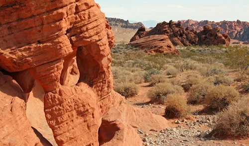
Lake Mead National Recreation AreaNational park site

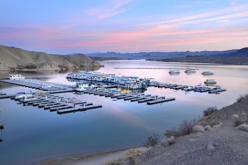
Lake Mead National Recreation Area

22 miles southeast · straight-line distance

Protected area in Clark County, Nevada and Mohave County, Arizona in the United States.

Confirm the visitor entrance, hours, reservations, access and seasonal conditions. Islands or water destinations may require different transport.
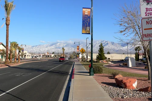
Ski area

Las Vegas Ski and Snowboard Resort

32 miles west · straight-line distanceAbout 55 min by car (52 road miles, typical traffic, checked October 2026)

Ski resort in Nevada, United States.

Confirm the visitor entrance, hours, reservations, access and seasonal conditions. Islands or water destinations may require different transport.
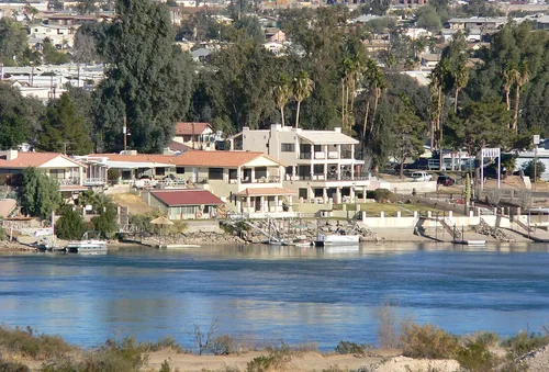
Valley of Fire State ParkState park

Valley of Fire State Park

37 miles northeast · straight-line distance

State park in Clark County, Nevada, United States.

Confirm the visitor entrance, hours, reservations, access and seasonal conditions. Islands or water destinations may require different transport.
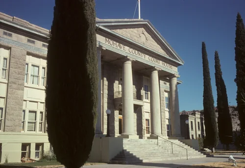
MesquiteTown

Mesquite

72 miles northeast · straight-line distanceAbout 1 hr 5 min by car (79 road miles, typical traffic, checked October 2026)

City in Clark County, Nevada, United States.

Confirm the visitor entrance, hours, reservations, access and seasonal conditions. Islands or water destinations may require different transport.
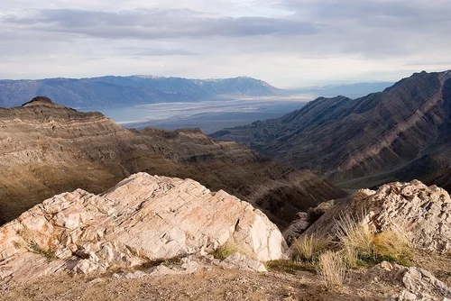
Bullhead CityTown

Bullhead City

81 miles south · straight-line distanceAbout 1 hr 35 min by car (102 road miles, typical traffic, checked October 2026)

City in Mohave County, Arizona, United States.

Confirm the visitor entrance, hours, reservations, access and seasonal conditions. Islands or water destinations may require different transport.
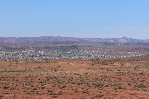
KingmanTown

Kingman

92 miles southeast · straight-line distanceAbout 1 hr 50 min by car (112 road miles, typical traffic, checked October 2026)

City in and seat of Mohave County, Arizona, United States.

Confirm the visitor entrance, hours, reservations, access and seasonal conditions. Islands or water destinations may require different transport.

Death Valley National ParkNational park site

Death Valley National Park

98 miles west · straight-line distance

National park in California and Nevada in the United States.

Confirm the visitor entrance, hours, reservations, access and seasonal conditions. Islands or water destinations may require different transport.

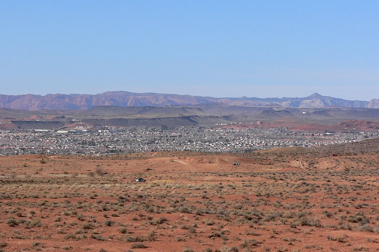
St. GeorgeTown

St. George

105 miles northeast · straight-line distanceAbout 1 hr 40 min by car (116 road miles, typical traffic, checked October 2026)

City in Washington County, Utah, United States.

Confirm the visitor entrance, hours, reservations, access and seasonal conditions. Islands or water destinations may require different transport.

State park

Snow Canyon State Park

107 miles northeast · straight-line distance

State park in Washington County, Utah, United States.

Confirm the visitor entrance, hours, reservations, access and seasonal conditions. Islands or water destinations may require different transport.

Driving times are typical estimates from the city center without live traffic, Powered by Geoapify · © OpenStreetMap contributors.

Distances are straight-line measurements from the city, not driving distance. Saved road estimates have no consistently recorded source date and are not current traffic; estimates to park centers, water locations or inconsistent routes are omitted. Named-destination route links are not verified entrances. Place descriptions come from Wikidata; photo credits below include recorded capture dates when available. A photograph does not show current conditions.

Outdoor places near North Las Vegas

40 recreation areas and campgrounds within 99 miles, from Recreation.gov. Filter by what you want to do.

Campground

Las Vegas Bay Campground

15 miles east · straight-line distanceAbout 35 min by car (23 road miles, checked October 2026)National Park Service

Las Vegas Bay Campground is located just minutes from Las Vegas on the western edge of the park. It’s open year-round and features paved sites that can accommodate tents or RVs, along with tables, fire pits and/or grills.

AmphitheaterBackpackingCampingHikingStar Gazing

Campground

Red Rock Canyon Campground

16 miles west · straight-line distanceAbout 25 min by car (22 road miles, checked October 2026)Bureau of Land Management

Red Rock Canyon's standard, RV, and group campsites are located in the stunning Red Rock Canyon National Conservation Area, an approximate 20 mile drive from "The Las Vegas Strip." Visitors enjoy hiking, rock climbing, bike riding and…

BikingCampingHikingHistoryHorseback ridingRanger programsRock ClimbingWildlife viewing

Recreation area

Red Rock Canyon National Conservation Area

18 miles west · straight-line distanceBureau of Land Management

Visit the red- and cream-colored sandstone cliffs and experience the natural wonders of the Mohave Desert just 17 miles west of the Las Vegas Strip.

BikingHikingHistoryPicnickingRanger programsWildlife viewing

Recreation area

Sloan Canyon NCA

20 miles south · straight-line distanceBureau of Land Management

Sloan Canyon National Conservation Area’s 48,438 acres provide peace and solitude for those who visit the unique scenic and geologic features and extraordinary cultural resources.

History

Recreation area

Desert National Wildlife Refuge

21 miles northwest · straight-line distanceFish and Wildlife Service

Encompassing six major mountain ranges and seven distinct life zones , Desert NWR showcases the abundance and variety of nature that can be found in Southern Nevada, all just a short drive from Las Vegas.

BackpackingBikingBirdingCampingEducational ProgramsHikingHorseback ridingHunting

Campground

Callville Bay Campground

22 miles east · straight-line distanceAbout 45 min by car (28 road miles, checked October 2026)National Park Service

Callville Bay Campground is located just minutes from Las Vegas along the northern edge of the Boulder Basin of Lake Mead.

BackpackingBikingCampingHiking

Recreation area

Hoover Dam

25 miles southeast · straight-line distanceBureau of Reclamation

Hoover Dam on the Colorado River, is a feature of the Boulder Canyon Project . Located on the Arizona-Nevada state line, at 726 feet it is the highest concrete dam in the United States, a National Historic Landmark, and one of America's…

BikingBoatingHikingHistoryNature educationRanger programsWildlife viewing

Campground

Spring Mountains Visitor Gateway Group Picnic Sites

27 miles west · straight-line distanceAbout 1 hr 5 min by car (59 road miles, checked October 2026)USDA Forest Service

The Spring Mountains Visitor Gateway (SMVG) complex includes a visitor center, an education and research building, two amphitheaters, two picnic sites and over 40 miles of adjoining trails.

BikingCampingHiking

Campground

Fletcher View

28 miles west · straight-line distanceAbout 1 hr 5 min by car (58 road miles, checked October 2026)USDA Forest Service

Fletcher View Campground is set in the beautiful Spring Mountains National Recreation Area, just 24 miles from Las Vegas. Visitors enjoy hiking, horseback riding and scenic driving in this forested desert oasis.

BikingCampingHikingWildlife viewing

Campground

Hilltop

28 miles west · straight-line distanceAbout 55 min by car (53 road miles, checked October 2026)USDA Forest Service

Hilltop Campground is set in the beautiful Spring Mountains National Recreation Area, just 40 miles from downtown Las Vegas. Visitors enjoy hiking, horseback riding and scenic driving in this forested desert oasis.

BikingCampingHiking

Campground

Kyle Canyon Picnic Area Day Use

28 miles west · straight-line distanceAbout 1 hr 5 min by car (58 road miles, checked October 2026)USDA Forest Service

Kyle Canyon Picnic Area is set in the beautiful Spring Mountains National Recreation Area, just 23 miles from Las Vegas. Visitors enjoy hiking, horseback riding and scenic driving in this forested desert oasis.

CampingHikingPicnickingWildlife viewing

Campground

Mahogany Grove

29 miles west · straight-line distanceAbout 55 min by car (52 road miles, checked October 2026)USDA Forest Service

Mahogany Grove Campground is set in the beautiful Spring Mountains National Recreation Area, just 40 miles from downtown Las Vegas. Visitors enjoy hiking, horseback riding and scenic driving in this forested desert oasis.

Camping

Campground

Cathedral Rock Picnic Area

30 miles west · straight-line distanceAbout 1 hr 10 min by car (61 road miles, checked October 2026)USDA Forest Service

Cathedral Rock Group Picnic Area is located at the top of beautiful Kyle Canyon in the Spring Mountains National Recreation Area, just 30 miles from Las Vegas.

CampingHiking

Campground

Foxtail Grp Picnic Area

32 miles west · straight-line distanceAbout 1 hr 25 min by car (51 road miles, checked October 2026)USDA Forest Service

Foxtail Group Picnic Area is located in the Spring Mountains National Recreation Area, just 47 miles from downtown Las Vegas. Visitors enjoy hiking, mountain biking, scenic driving, and winter snowplay in this forested desert oasis.

BikingBirdingCampingHiking

Campground

Mcwilliams

32 miles west · straight-line distanceAbout 55 min by car (51 road miles, checked October 2026)USDA Forest Service

McWilliams Campground is located in the Spring Mountains National Recreation Area, just 50 miles from downtown Las Vegas. Visitors enjoy hiking, mountain biking and scenic driving in this forested desert oasis.

BikingCampingHiking

Recreation area

Mount Wilson Wilderness

34 miles southeast · straight-line distanceBureau of Land Management

The 23,900-acre Mount Wilson Wilderness Area is located in Mohave County, Arizona, approximately 30 miles southeast of Las Vegas, Nevada, and 60 miles northwest of Kingman, Arizona.

BackpackingDispersed CampingHikingWildernessWildlife viewing

Recreation area

Arrow Canyon Wilderness

37 miles northeast · straight-line distanceBureau of Land Management

The Arrow Canyon Wilderness now contains a total of 27,530 acres and is managed by the Bureau of Land Management. All of the Wilderness is in the state of Nevada.

HikingWilderness

Campground

Echo Bay Campground

39 miles east · straight-line distanceAbout 1 hr 15 min by car (53 road miles, checked October 2026)National Park Service

Echo Bay Campground is located in the northern end of the park along the Overton Arm of Lake Mead. It’s open year-round and features paved sites that can accommodate tents or RVs, along with tables, fire pits and/or grills.

BoatingCampingFishingHikingPicnickingRanger StationWater Access

Recreation area

Highland Range Crucial Bighorn Habitat

40 miles south · straight-line distanceBureau of Land Management

The area was set aside for the protection and propagation of desert bighorn sheep. No public access. US 95 runs along the eastern flank of the area.

Wildlife viewing

Recreation area

Moapa Valley National Wildlife Refuge

42 miles northeast · straight-line distanceFish and Wildlife Service

The Moapa Valley National Wildlife Refuge was established on September 10, 1979, to secure habitat for the endangered Moapa dace, a small fish endemic to the headwaters of the Muddy River system.

Educational Programs

Recreation area

Stateline Wilderness

44 miles southwest · straight-line distanceBureau of Land Management

The small but pristine Stateline Wilderness contains the eastern terminus of the 15 mile long Clark Mountain Range. The limestone/dolomite mountains are steep and rugged.

HikingWilderness

Recreation area

Lake Mead National Recreation Area

46 miles east · straight-line distanceNational Park Service

Experience outdoor thrills, striking landscapes, and brilliant blue waters. This year-round recreation area spreads across 1.5 million acres of mountains, canyons, valleys and two vast reservoirs.

BikingBoatingCampingDivingFishingHikingHorse CampingHorseback riding

Recreation area

Pahrump Valley Wilderness

46 miles southwest · straight-line distanceBureau of Land Management

The Pahrump Valley in the north, the Mesquite Valley in the southeast, and the California Valley in the west join forces in this desolate, seldom-visited Wilderness.

CampingHikingHorseback ridingHuntingNature educationPhotographyRanger programsWilderness

Recreation area

Mesquite Wilderness

47 miles southwest · straight-line distanceBureau of Land Management

The Mesquite Wilderness consists of portions of the Mesquite Mountains, Mesquite Valley, and the Clark Mountain Range. Numerous small caves are found in the porous rock of the Clark Mountains.

CampingHikingHorseback ridingHuntingPhotographyWildlife viewing

Recreation area

North Mesquite Mountains Wilderness

50 miles southwest · straight-line distanceBureau of Land Management

The North Mesquite Mountains Wilderness consists of the broad western end of Sandy Valley and the northern portion of Mesquite Mountains.

CampingHikingHorseback ridingHuntingPhotographyWildlife viewing

Recreation area

Horsethief Springs/Cabin

52 miles southwest · straight-line distanceBureau of Land Management

Horsethief Springs offers excellent bird and wildlife viewing. This perennial spring provides life giving water for resident wildlife and migrating birds alike. Wildlife viewing is best during early morning and evening hours.

CampingHikingHuntingNature educationPhotographyWildlife viewing

Recreation area

Clark Mountain Camp

54 miles southwest · straight-line distanceBureau of Land Management

Clark Mountain Camp is located on the southern end of the Clark Mountain Range. It is also within the Clark Mountain Area of Critical Environmental Concern (ACEC).

BikingCampingHikingHorseback ridingHuntingPhotographyWildlife viewing

Recreation area

Nopah Range Wilderness

56 miles west · straight-line distanceBureau of Land Management

The Nopah Range Wilderness now contains a total of 106,620 acres and is managed by the Bureau of Land Management. All of the Wilderness is in the state of California.

HikingWilderness

Recreation area

Gold Butte National Monument

57 miles northeast · straight-line distanceBureau of Land Management

Inside the rugged 296,937-acre Gold Butte National Monument is an extraordinary variety of pre-historic, historic, geological, and biological treasures.

BackpackingHikingHorseback ridingOff-highway vehicles

Recreation area

Kingston Range Wilderness

60 miles southwest · straight-line distanceBureau of Land Management

The Kingston Range Wilderness is divided into three units by non-wilderness corridors or 'cherrystems': Sperry Wash and Kingston Wash.

Wilderness

Recreation area

South Nopah Range Wilderness

60 miles southwest · straight-line distanceBureau of Land Management

Easily rolling alluvial slopes (bajadas) from the east and west sweep gently up to the south end of the rugged folds of the Nopah Mountain Range in the South Nopah Range Wilderness.

HikingWilderness

Recreation area

Gold Butte Back Country Byway

62 miles northeast · straight-line distanceBureau of Land Management

One of the first designated backcountry byways, the Gold Butte Back Country Byway travels through some of the most remote landscapes of southern Nevada.

CampingHorseback ridingOff-highway vehiclesPhotographyScenic DriveWildlife viewing

Recreation area

Castle Mountains National Monument

63 miles south · straight-line distanceNational Park Service

Castle Mountains represents some of the most unique elements of the Mojave Desert.

Camping

Recreation area

Resting Spring Range Wilderness

63 miles west · straight-line distanceBureau of Land Management

Hunting, fishing, and non-commercial trapping are allowed under state and local laws.Pet are allowed, but please keep your pets under control at all times.Horses are permitted, however you may be required to carry feed.

CampingHikingHorseback ridingHuntingNature educationPhotographyRanger programsWilderness

Recreation area

Ash Meadows National Wildlife Refuge

69 miles west · straight-line distanceFish and Wildlife Service

Ash Meadows National Wildlife Refuge was established June 18, 1984. Managed by the U.S. Fish & Wildlife Service, the refuge protects threatened and endangered species, many of which occur nowhere else in the world.

BirdingHuntingPhotographyPicnickingRanger programs

Recreation area

Mount Tipton Wilderness

69 miles southeast · straight-line distanceBureau of Land Management

The 30,760-acre Mount Tipton Wilderness is located in Mohave County, 25 miles north of Kingman, Arizona. This wilderness includes the entire northern half of the imposing Cerbat Mountains.

CampingDispersed CampingHikingHorseback ridingPhotographyWilderness

Campground

Windy Point Campground

75 miles southeast · straight-line distanceAbout 2 hr 15 min by car (98 road miles, checked October 2026)Bureau of Land Management

Located on the crest of the Cerbat Mountains, Windy Point Campground provides visitors scenic views of the surrounding valley and distant mountain ranges.

Bird WatchingCampingCamping AreaWildlife viewing

Campground

Virgin River Canyon Recreation Area

90 miles northeast · straight-line distanceAbout 1 hr 25 min by car (98 road miles, checked October 2026)Bureau of Land Management

The Virgin River Canyon Recreation Area is located along Interstate 15 approximately 20 miles southwest of St. George, Utah and approximately 20 miles northeast of Mesquite, Nevada. It's accessed from the Cedar Pocket Exit (mile post 18).

CampingHikingPicnicking

Campground

Death Valley Backcountry Roadside Camping

99 miles west · straight-line distanceAbout 2 hr 15 min by car (145 road miles, checked October 2026)National Park Service

PLEASE BE AWARE: These are primitive sites that do not offer water, electricity, toilet access, or any amenities. Most primitive roadside campsites require a high clearance vehicle, and 4-wheel drive is highly encouraged.

BackpackingCampingHikingMountain BikingOff Road Vehicle TrailsStar GazingWildernessWildlife viewing

Campground

Furnace Creek Campground

99 miles west · straight-line distanceAbout 2 hr 15 min by car (145 road miles, checked October 2026)National Park Service

Furnace Creek Campground is the only NPS campground in the park that is reservable. All other NPS campgrounds operate on a first-come, first-serve basis.

BikingBirdingCampingGuided Interpretive WalksHikingHistoryPhotographyRanger programs

Recreation areas and campgrounds from Recreation.gov's directory, checked October 9, 2026. Listings are not live availability: check Recreation.gov or the managing agency for open dates, fees, reservations and conditions. Directions go to the listed coordinates, which may not be the entrance. Campground driving times: Powered by Geoapify · © OpenStreetMap contributors.

Questions

What day-trip ideas are near North Las Vegas?

This guide includes Spring Mountain Ranch State Park, Boulder City, Lake Mead National Recreation Area, Las Vegas Ski and Snowboard Resort, Valley of Fire State Park. Places are ordered by straight-line distance. Confirm visitor access, opening hours and current travel conditions before choosing a trip.

How far is Spring Mountain Ranch State Park from North Las Vegas?

Approximately 21 miles southwest in a straight line. This is not current traffic or a route to a verified visitor entrance. Use the named destination and confirm the appropriate entrance or transport.

How far is Boulder City from North Las Vegas?

Approximately 22 miles southeast in a straight line; driving takes about 30 min over 28 road miles in typical traffic (Geoapify, checked October 2026). This is not current traffic or a route to a verified visitor entrance. Use the named destination and confirm the appropriate entrance or transport.

How far is Lake Mead National Recreation Area from North Las Vegas?

Approximately 22 miles southeast in a straight line. This is not current traffic or a route to a verified visitor entrance. Use the named destination and confirm the appropriate entrance or transport.

Where can I camp near North Las Vegas?

Recreation.gov lists 16 campgrounds within 99 miles, including Las Vegas Bay Campground (15 miles east), Red Rock Canyon Campground (16 miles west), Callville Bay Campground (22 miles east). Check Recreation.gov for current availability, seasons and reservations.

Local events, things to do, and independent businesses worth knowing.

North Las Vegas AI

Your North Las Vegas local guide
Hey there!

I'm North Las Vegas AI. Ask about local food, shopping, history or a day out.

AI recommendations may be inaccurate. Verify hours and prices. Questions are processed by Cloudflare. Privacy